


Staff Reporter:
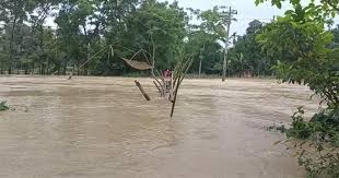
Cyclonic storm ‘Remal’ is expected to enter southern district of Bangladesh from midnight as the Met Office forecasted to make landfall in the coastal districts Satkhira and Cox’s Bazar by tomorrow evening.
“The edge of cyclone may enter parts of Bangladesh from midnight . . . under the influence of cyclone, Bangladesh, particularly its southern and southeastern regions may witness heavy to very rainfall,” Director General of Department of Disaster Management Mizanur Rahman told BSS this evening.
He said the government has taken all necessary preparations to handle any destructive situation caused by the cyclone.
The DG also said the authorities already directed all relevant organizations alongside involving 78,000 volunteers for launching massive evacuation drive to shift vulnerable populations to safer places.
Referring to the data of the Met Office, Mizanur said as large size of radius of the cyclone has been developed and significant rainfall may occur in 19 costal districts side by side central parts of the country.
Maritime ports of Chattogram, Cox’s Bazar, Mongla and Payra have been advised to hoist local cautionary signal number three lowering distant cautionary signal number in the wake of the deep depression over the North Bay, a special weather bulletin of Bangladesh Meteorological Department (BMD) said on Saturday.
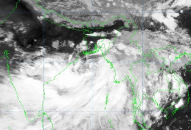
The deep depression over East central bay and adjoining west central bay moved northwards over the same area (near lat: 18.2on, lon: 89.8oe) and was centered at 12 noon about 500 kms southwest of Chattogram port, 435 kms southwest of Cox’s Bazer port, 475 kms south of Mongla port and 425 kms south of Payra port, it added.
All fishing boats and trawlers over North Bay and deep sea have been advised to take shelter immediately.
The deep depression over eastcentral Bay of Bengal moved nearly northwards with a speed of 11 kmph during past 6 hours and lay centered at 12noon of 25th may, 2024 over the same region near latitude 18.2on and longitude 89.7oe, about 420 km south of Khepupara, about 420 km south-southeast of Sagar Islands (West Bengal) and 460 km south-southeast of canning (West Bengal), according to the Indian Meteorological Department (IMD).
It is very likely to continue to move nearly northwards and intensify into a cyclonic storm over Eastcentral and adjoining north bay of Bengal around 25 May evening.
It would intensify into a severe cyclonic storm by 26th may morning and cross Bangladesh and adjoining West Bengal coasts between Sagar Island and Khepupara by May 26 midnight as a severe cyclonic storm with wind speed of 110-1 20 gusting to 135 kmph.